Whether you are hiring bikes or using your own, you can pick up a free cycle route map from Hassocks Community Cycle Hire. Each map details one of our circular routes that starts and finishes at Hassocks Station. Also available from local shops, stations and visitor attractions. Or you can download from the following links. We also sell Ordnance Survey maps.
Routes
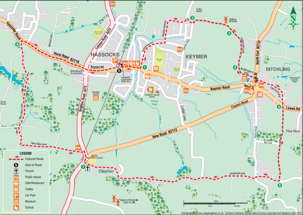
Route 1: Hassocks, Ditchling and Clayton (Approx 8 miles / 13 km) This takes in Oldland Mill, the charming village of Ditchling with its many Elizabethan buildings and the Saxon church at Clayton, beneath Jack and Jill Mills and back via to Hassocks passing the historic Danny House, where the terms of the armistice to be offered to Germany were agreed by the allies in 1918.
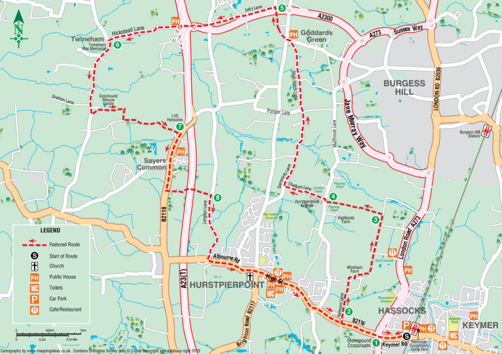
Route 2: Hassocks, Goddards Green, Twineham, Sayers Common, Hurstpierpoint (Approx 12 miles / 19.5km) This route goes further north into Mid Sussex, via the Grade 2 listed pub The Sportsman, north of Hurstpierpoint.
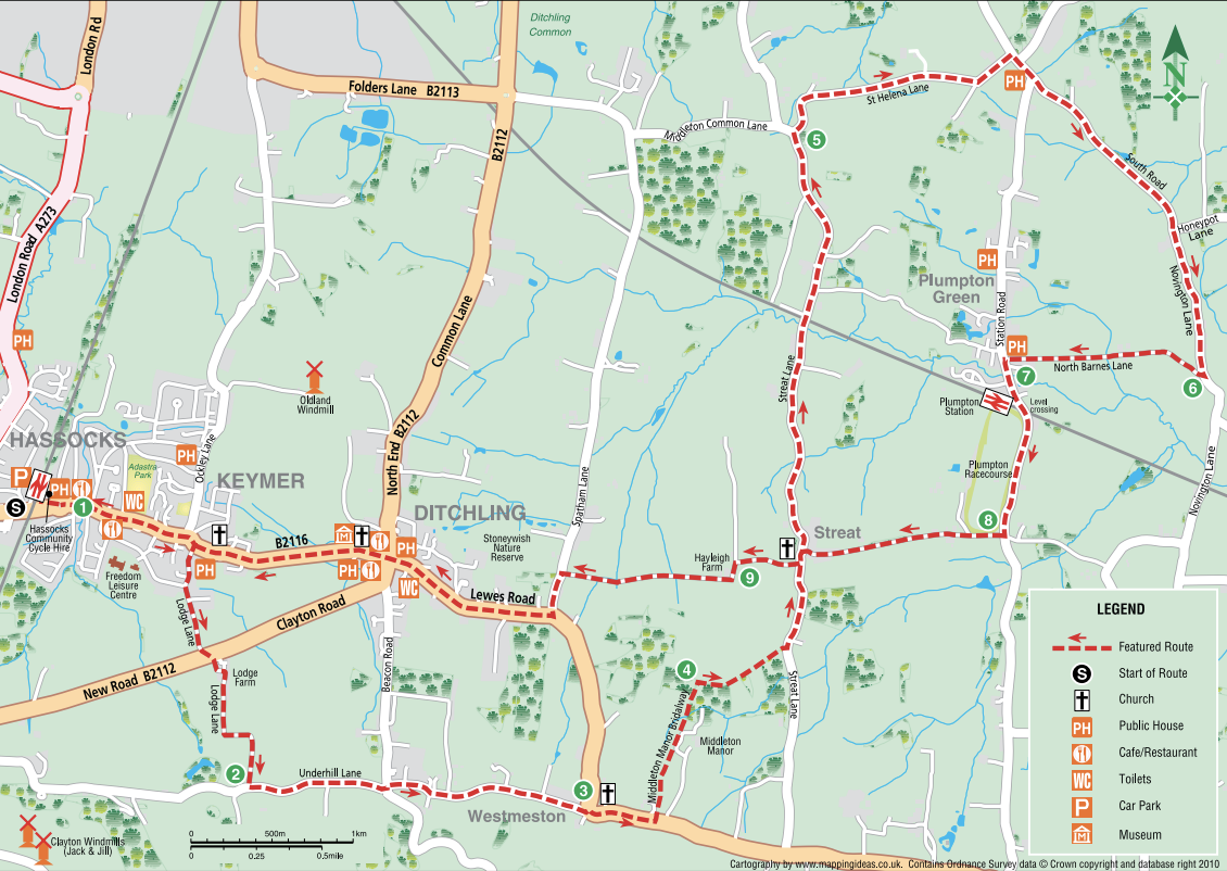

Route 3: Hassocks, Westmeston, Streat, Plumpton, Ditchling (Approx 14.5 miles / 23 km) This takes you on a figure of 8 to the small parish of Streat and around Plumpton, where there is a race course, shops and several pubs.
Route 4: Burgess Hill Green Route, Goddards Green, Hurstpierpoint College (Approx 8 miles / 13 km)
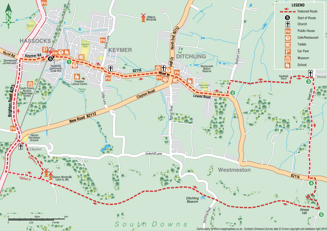
Route 5: Ditchling and the top of the South Downs (Approx 10.5 miles / 17 km) This route will take you along the top of the Downs, past Jack and Jill mills and Ditchling Beacon and via the hamlet of Street.
West Sussex County Council cycle journey planner. Enter start and end points, choose fastest, quietest or balanced route and the journey planner will give you directions, a map and elevation profile as well as distance and estimated journey time.